
AGS monitors mountain 116 years after deadly rockslide
Alberta - May 13, 2019The Tortoise and the Hare, a fable of slow and steady work, is something the Alberta Geological Survey (AGS) can relate to when it comes to Turtle Mountain—a mountain in Alberta’s Crowsnest Pass that geologists have been studying since a fatal rockslide occurred over a century ago.
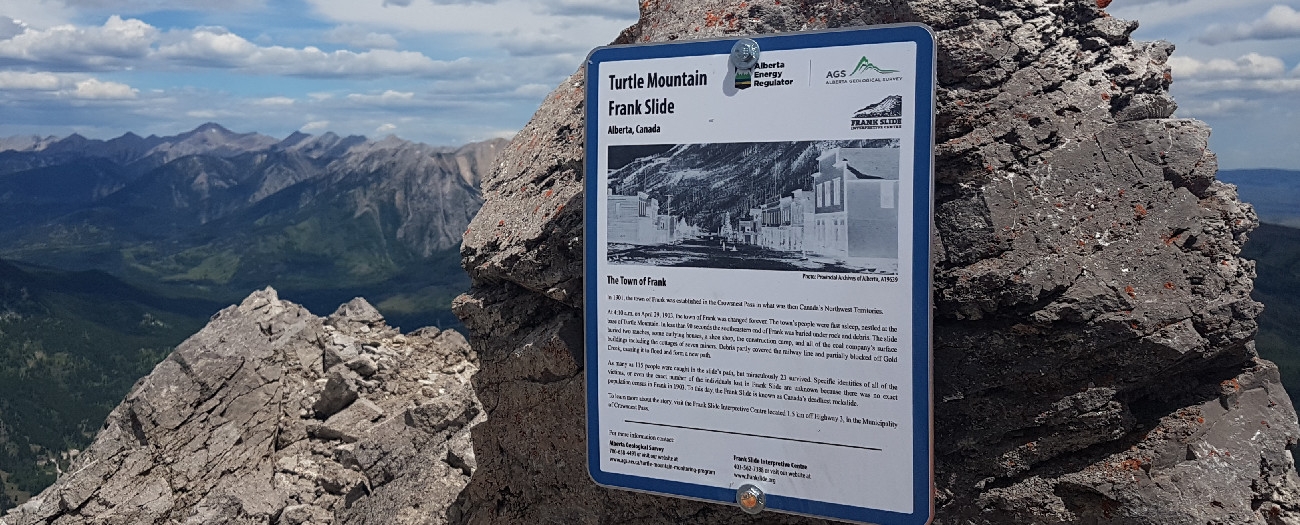
On April 29, 1903, one of the worst rockslides in Canadian history occurred on Turtle Mountain. In less than two minutes, the mountain released 30 million cubic metres (over 80 million tonnes) of rock onto the sleeping town of Frank below, claiming the lives of at least 90 people. This tragedy is known today as the Frank Slide.
Over the last century, the mountain has been studied using a variety of tools, including cameras that capture near-real-time footage of the South Peak (South Peak webcam) and of the base of the valley (Bellevue webcam).
Since the cameras were installed in 2007 by AGS, a branch of the Alberta Energy Regulator (AER), the footage has been used to alert those living in the Municipality of Crowsnest Pass of movements on the mountain (there haven’t been significant shifts in the mountain since 1903), and to create time-lapse videos that are shared on the AGS website. In less than four minutes, viewers can watch a year’s worth of clips from the cameras’ live steams, starting at noon each day.
"The videos are a way to balance our monitoring system," says Todd Shipman, a senior advisor of landscape and geological hazards with AGS. "We can see what might be happening, then verify if there are concerns. I also think the visual provides reassurance to people—they can see if there are any changes on the mountain and know that we are watching all the time."
The AGS will be talking about the work it does and the innovative tools it uses at GeoConvention 2019 from May 13-15.
Bellevue - Turtle Mountain 2018 Year in Review
South Peak - Turtle Mountain 2018 Year in Review
Paula Ogonoski, Writer