
Inspecting road crossings help protect fish and their ecosystems
Alberta - July 16, 2018On the surface, it’s not always obvious how things are linked together, and solving a problem often requires looking deeper into possible connections. When it comes to assessing environmental impacts of resource development, no detail is too small to be considered.
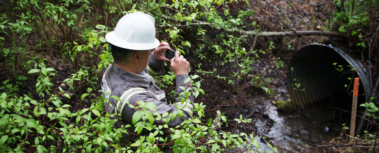
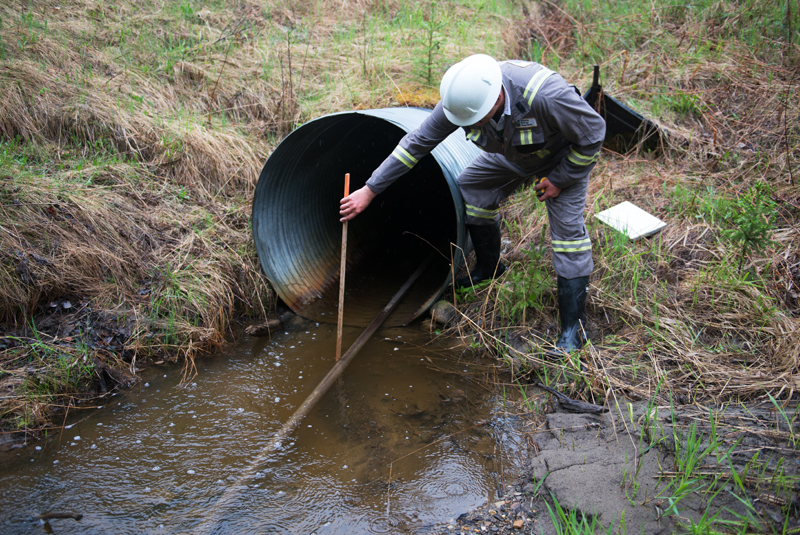
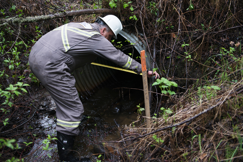
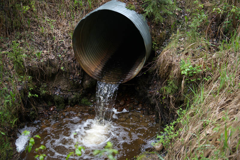
For decades, various fish species in Alberta have been threatened because their habitat is fragmented by poorly constructed or maintained roadway water crossings, such as culverts and bridges. Culverts are corrugated steel pipes that allow water to flow under roads or rails, and there are tens of thousands of culverts throughout Alberta, including ones owned by energy companies.
People may not realize it, but a single bad watercourse crossing can impact an entire watershed.
Stefan Bittner, field inspector
There are many factors that impact fish, like poorly designed and undersized culverts, erosion, and sedimentation. These prevent fish from moving upstream and spawning, and they also clog their gills—all of which can lead to the loss of populations in these areas.
The Alberta Energy Regulator (AER) is working with the Foothills Stream Crossing Partnership to help protect fish populations that are being negatively affected by inadequate crossings throughout the province. This work aims to catalogue watercourse crossings for possible remediation in order to reintroduce fish to areas from which they may have been driven by industrial activity.
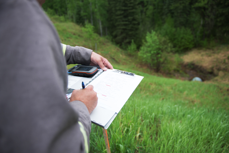
A critical part of this work includes inspecting crossings to ensure that they meet structural and operating standards. The AER notifies companies if problems are identified; they then have 30 days to submit a plan that addresses the issues. Companies that are members of the partnership have more time to submit their remediation plans.
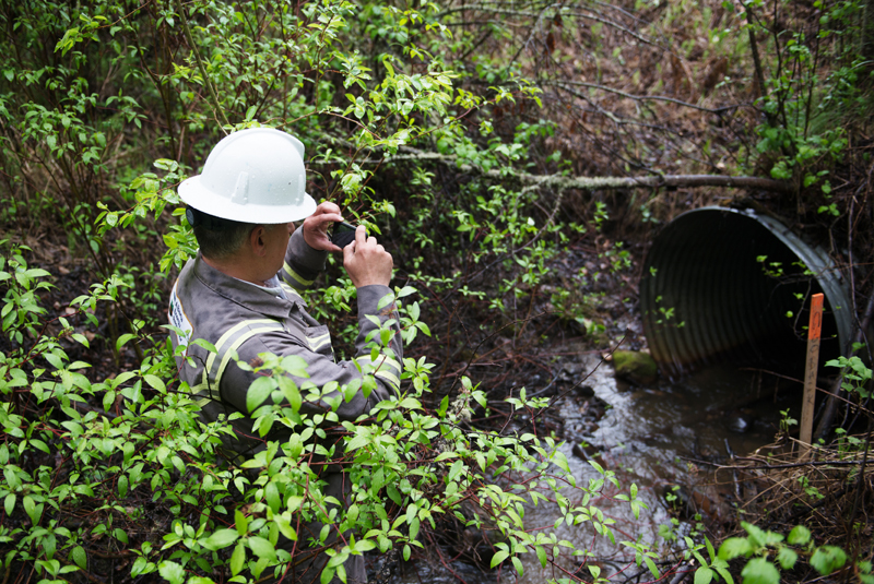
Recently, Stefan Bittner, an AER field inspector, spent an afternoon inspecting culverts in a thickly forested area with significant energy development about an hour outside of Drayton Valley. Some days Bittner will put close to 600 kilometres on his truck doing his inspections.
“It’s a lot of work to properly catalogue the crossings, given the large number of them across the province,” Bittner says. “However, it’s very important to help preserve and protect the natural way of things. People may not realize it, but a single bad watercourse crossing can impact an entire watershed. I love the outdoors and I love nature. That’s why I take this work so seriously.”
Kate Bowering, Writer
Luke Spencer, Digital Media