
How the AER is using drones to inspect oil and gas sites
Alberta - September 11, 2018It’s a bird, it’s a plane. Nope, it’s a drone.
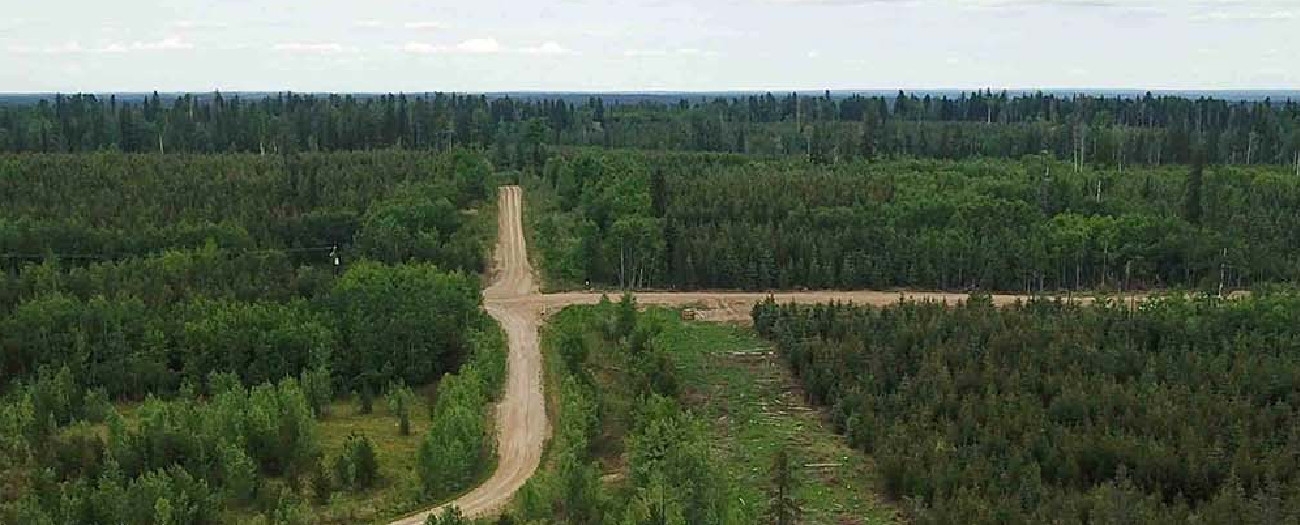
Aerial monitoring technology has changed the way the Alberta Energy Regulator (AER) monitors oil and gas facilities for the better. It saves thousands of staff hours a year by eliminating the need to physically access sites. Inspectors simply fly the drones over the area and see everything they need to, and the overhead perspective can be more effective at identifying potential issues.
I can spend 10 minutes flying over the route versus spending two-to-three hours trekking across the tough terrain.
Derek Flewell, field inspector
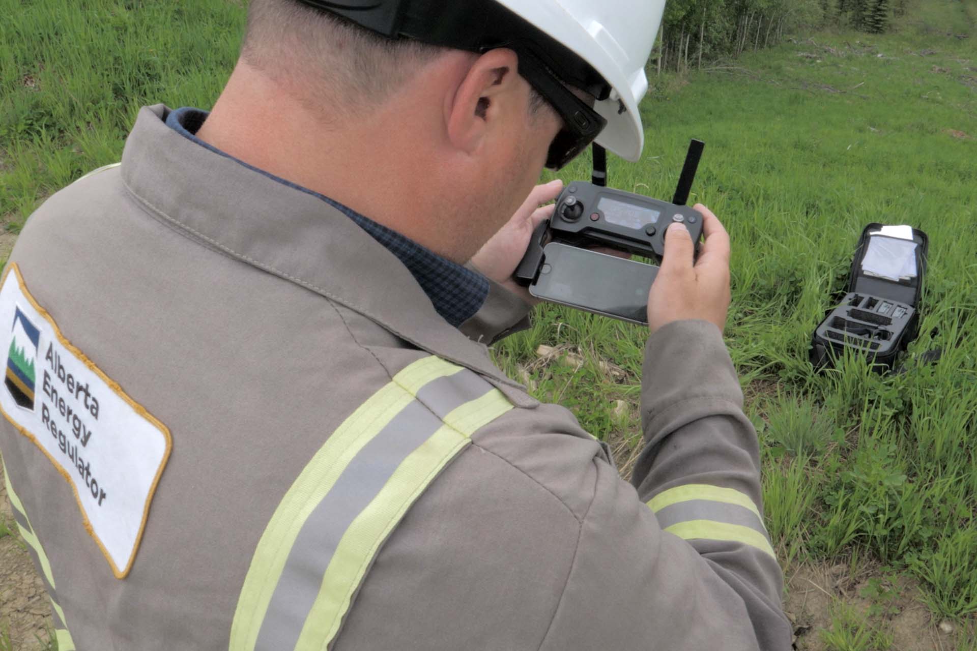
Derek Flewell is a field inspector with the AER. He is one of three inspectors out of the Drayton Valley office who is licensed to fly drones. Yes that’s right: you need special training to fly a drone.
To get a drone pilot’s licence you need to complete a three-day course. And taking flight isn’t as simple as pushing the start button, as you might expect. Proposed drone flights need to be logged for aviation authorities, and there are restrictions on how high and how far away from you the drone can travel. Flights are completely weather dependant as drones can’t fly in rain or heavy wind.
Flewell notes that, “using the drone makes my day so much more efficient. I can spend 10 minutes flying over the route versus spending two-to-three hours trekking across the tough terrain. Plus I get to see everything I need to see from a better vantage point using the overhead footage.”
For this particular inspection, there are certain elements on the pipeline right-of-way that Flewell needs to see to ensure that the site is compliant. He is looking for access control of the route to protect wildlife from hunters, and erosion protection on the slope to ensure that the ground is safeguarded. One of the most commonly used forms of access control is rollback, whereby tree stumps and branches are placed over the route to create obstacles.
“This area is heavily developed, but it still looks very natural. They’ve done a good job,” adds Flewell.
In a matter of minutes, Flewell’s inspection of the site is complete, the drone is packed away, and Flewell is free to head out to his next inspection.
Watch the video to see the drone inspection.
Kate Bowering, Writer
Luke Spencer, Digital Media